MINING LEGACIES
Images and impacts from mining in Australia
Home
About
Submit
Reports and Articles
Map
Mines
NSW
Kurri Kurri
Sunny Corner
Woodsreef
Ottery
NT
Adelaide River
Eva Creek
McArthur River
Redbank
Rum Jungle
Merlin
QLD
Baal Gammon
Emuford
Mary Kathleen
Mount Morgan
Poison Water
Tabletop
Irvinebank
Jumma
Chillagoe
Croydon
George Creek
Mount Oxide
Mount Garnet
Red Dome
SA
Mount Gunsun
Wild Dog
TAS
Avebury
Mt Lyell
Rosebery
Zeehan
VIC
Benambra
Central Victorian Goldfields
WA
Bulong
Gidgee
Lake Johnstone
Mt Goldsworthy
Ragged Hills
Wittenoom
Entropy
Mt. Lyell, TAS
Woodsreef, NSW
Central Victorian Goldfields
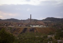
Mount Morgan Mine, QLD
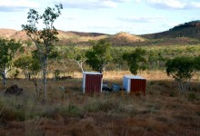
Eva Creek, NT
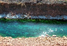
Redbank Mine, NT
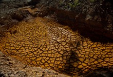
Baal Gammon, QLD
McArthur River, NT
Emuford, QLD
Rum Jungle, NT
Gidgee, Western Australia
1
2
Next →